Business Details
7 Years
experience
Emergency
services
Expert Drone Photography & Mapping Services in Oxford
Established in 2019, we are a CAA-licensed commercial drone operator based in South Oxfordshire. Our team combines extensive flight experience with professional photography and video editing expertise to deliver high-quality aerial imagery solutions. With over 1,000 flights completed and two decades of post-production experience, we serve diverse clients including property developers, farmers, and government agencies. Our services adhere strictly to UK aviation regulations, with all operations fully logged and insured to CAA-approved standards. We utilise advanced drone technology to provide precise mapping, property inspections, and event coverage, offering both raw footage and fully edited deliverables.Our Google Trusted Photographer certification enables integration of 360 panoramas into Google Maps, enhancing business visibility. We prioritise safety and legal compliance, refusing unsafe jobs while offering alternative land-based solutions when necessary. Clients receive high-resolution media in accessible formats, with permanent cloud storage provided for all projects. Our equipment range ensures optimal tools for every task, from residential property photography to large-scale construction monitoring. Backed by NATS Verified Drone Professional status, we maintain rigorous operational records and risk assessments to ensure client safety and satisfaction.
Services
Drone Photography
Roof Inspections
Drone Mapping
Wedding Photography
360 Panoramas
Details
- Year established: 2019
Highlights and features
- CAA-registered operator since 2019 with 1,000+ flights completed
- Google Trusted Photographer certification for Google Maps integration
- 24/7 availability for urgent aerial inspection requirements
- Comprehensive safety protocols exceeding UK aviation regulations
- Dual expertise in drone operations and professional post-production editing
Associations and certifications
- CAA (Civil Aviation Authority)
What people say
Exceptional aerial quality
Professional and reliable
Excellent Google integration
Competitive pricing structure
Safety-first approach
Services
Drone Photography
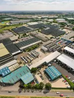
Professional aerial photography services capturing high-resolution images for property marketing, construction documentation, and event coverage. Our CAA-certified operators use advanced drones to create visually striking content suitable for print and digital platforms. Clients receive both raw files and professionally edited deliverables, with options for framed prints or large-format displays.
Roof Inspections
Non-invasive roof and chimney inspections using precision drone technology. This service eliminates safety risks associated with traditional methods while providing photographic evidence of structural conditions. Ideal for property owners and contractors requiring accurate assessments without scaffolding costs or potential builder disputes.
Drone Mapping
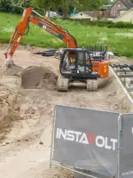
High-accuracy 2D and 3D mapping services for agricultural, construction, and property development projects. Our pre-programmed flights capture overlapping images for detailed terrain analysis, with resolution down to less than 1 pixel per inch. Deliverables include Google Maps overlays with measurement tools for precise planning and monitoring.
Wedding Photography
Aerial wedding and event photography capturing unique perspectives of special occasions. We provide both raw footage and edited highlights, working directly with couples or in collaboration with ground photographers. Services include venue aerials and dramatic fly-through sequences, with weather contingency planning to ensure client satisfaction.
360 Panoramas
Certified Google Trusted Photographer service creating immersive 360-degree aerial panoramas. These interactive visuals enhance business listings on Google Maps and websites, ideal for hospitality venues, retail spaces, and property developments seeking to showcase their premises in engaging formats.
Questions
What areas do you cover?
We operate throughout Oxfordshire and surrounding counties including Berkshire, with regular service to Oxford, Wantage, Didcot, Abingdon, and Reading.
Are you CAA licensed?
Yes, we hold current CAA permissions and maintain NATS Verified Drone Professional status with all flights fully logged and insured.
Can you inspect roofs without scaffolding?
Our drone inspections provide detailed roof and chimney assessments without requiring scaffolding, saving both time and costs.
Do you offer event photography?
We provide aerial wedding and event coverage, working with clients or photographers to capture unique perspectives of special occasions.
How are mapping projects conducted?
Our drone mapping uses pre-programmed flights to create 2D/3D models with sub-inch resolution, suitable for construction, agriculture, and development planning.
What formats do you provide?
Clients receive high-resolution digital files, cloud storage access, and optional physical prints or Google Maps integration for business listings.
Videos