Business Details
Professional Drone Photography Services in Southport
Established to provide cutting-edge aerial imaging solutions, we specialise in drone-based photography and videography for diverse industries. Our team combines decades of aviation and photographic expertise, including over 400 hours of mixed flying experience and recognition from the Royal Photographic Society. We deliver precision land surveys, environmental monitoring, structural inspections, and advertising content while maintaining strict compliance with Civil Aviation Authority regulations.Our real-time video streaming capability allows clients to guide operations for optimal results. With a focus on safety and cost-efficiency, we eliminate the need for traditional high-risk access methods like scaffolding. Operating from Southport, we serve Merseyside, Cheshire, Lancashire, and beyond, offering tailored solutions for real estate, agriculture, event management, and infrastructure projects.
Services
Aerial Photography
Drone Hire
Land Survey
Environmental Monitoring
Structural Survey
Advertising Imagery
School Photographs
Highlights and features
- We hold official CAA Permission for Aerial Work (Ref: 20190619PAndEUAS2148)
- Our pilot has 400+ hours of combined light aircraft and UAV experience
- Real-time video streaming enables client-guided precision operations
- Cost-effective alternative to traditional high-altitude access methods
- Award-winning photographic expertise from the Royal Photographic Society
Associations and certifications
- Civil Aviation Authority
- Royal Photographic Society
What people say
Excellent work
Help analyse objectives
More sustainable festival
Services
Aerial Photography
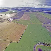
High-resolution aerial photography using advanced UAV technology for commercial and environmental applications. Captures detailed visual data for real estate marketing, agricultural analysis, and infrastructure documentation. Provides unique perspectives that enhance marketing materials and operational planning.
Land Survey
Precision land surveying services for agricultural and environmental monitoring. Uses drone-mounted cameras to assess crop health, identify drainage issues, and map large areas with positional accuracy. Enables targeted interventions for improved agricultural productivity and environmental management.
Structural Survey
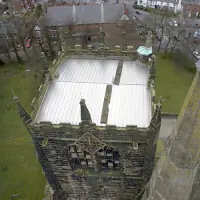
Non-invasive structural inspection services for roofs, chimneys, and tall buildings. Captures high-definition images of hard-to-reach areas without requiring physical access equipment. Cost-effective solution for maintenance planning and safety compliance in commercial and residential properties.
Environmental Monitoring
Specialised drone services for environmental assessment and conservation projects. Monitors flood defences, land drainage, and ecological changes through repeatable flight patterns. Provides accurate data for environmental audits and sustainability initiatives at events like the Glastonbury Festival.
Advertising Imagery
Creative aerial imaging solutions for commercial advertising and promotional materials. Captures striking visuals of hotels, golf courses, and real estate developments from unique angles. Enhances marketing campaigns with cinematic-quality footage that showcases properties in their best light.
People
Martin Maynard
Pilot & Owner
Experienced pilot with 400+ hours of combined light aircraft and UAV operations. Holds CAA Permission for Aerial Work and an Associateship from the Royal Photographic Society for contemporary photography. Specialises in commercial drone applications and environmental monitoring.
Sarah Love
Co-Owner
Co-founder of ML Aerial Photography with operational responsibility for business development and client relations. Works closely with Martin Maynard to ensure compliance with aviation regulations while expanding the company's service offerings across multiple industries.
Questions
Is ML Aerial Photography legally permitted for commercial drone operations?
Yes, we hold official CAA Permission for Aerial Work (Ref: 20190619PAndEUAS2148) for all commercial drone operations.
What types of aerial imaging services do you offer?
We provide land surveys, structural inspections, environmental monitoring, advertising content, and event documentation using high-resolution drone technology.
Which geographic areas do you cover?
We operate throughout Merseyside, Cheshire, and Lancashire, with nationwide coverage available by prior arrangement.
Can clients view footage during drone operations?
Yes, our real-time video streaming allows clients to monitor and guide operations from the ground.
What safety advantages do your drone services offer?
Our drones eliminate the need for traditional high-risk access methods like scaffolding, reducing both safety risks and costs.